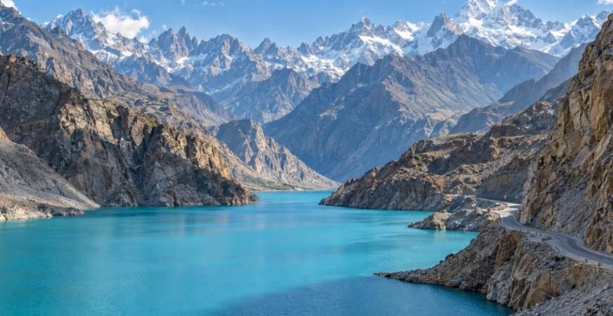
Nothing prepares you for the visual scale of the Karakoram and western Himalayas. Standing at 8,000 feet, you watch sheer granite spires plunge into milky glacial rivers while ancient apricot orchards cling to steep cliffs. If you want to explore the top scenic valleys in northern pakistan, you need to navigate very different topographies, road systems, and cultural landscapes.
Overland travel across this terrain demands more than a camera. It requires understanding when snow blocks high passes, which valleys allow standard sedans, and where you must secure a high-clearance 4×4. The northern region divides naturally into two distinct zones: the high-altitude, arid, moonscape peaks of Gilgit-Baltistan, and the lush, dense alpine river basins of Khyber Pakhtunkhwa.
The Crown Jewels of Gilgit-Baltistan
Traveling north from Islamabad brings a dramatic change in geography. As the air thins, pine forests give way to massive barren rock faces, hanging glaciers, and the storied Karakoram Highway (KKH).
Hunza Valley: Terraces, Glacial Lakes, and Ancient Fortresses
Hunza remains the benchmark for alpine beauty in Central and South Asia. Ringed by 7,000-meter giants like Rakaposhi, Ultar Sar, and Ladyfinger Peak, the valley showcases centuries of human resilience. Terraced fields irrigated by mineral-rich glacial melt turn vibrant green in spring and burn bright gold by October.
I spent days navigating the steep alleys of Karimabad, exploring the 700-year-old Baltit Fort and the 1,100-year-old Altit Fort. Both structures reveal the deep architectural ties that once bound northern Pakistan with the Silk Road oasis kingdoms further north.
If you are exploring regional trade history or planning excursions to Central Asia, comparing this corridor to the ancient caravan stops and places to visit in the silk road uzbekistan reveals how art and timber construction migrated across these high mountain passes.
Beyond Karimabad, the valley opens up at Attabad Lake. A massive 2010 landslide blocked the Hunza River, submerging 12 miles of the original highway. Today, its turquoise waters contrast sharply with the raw gray cliffs around it.
Drive another hour north, and the iconic serrated needles of the Passu Cones (Tupopdan) rise sharply above the highway.
- Key Highlights: Baltit and Altit Forts, Attabad Lake boat crossings, Passu Glacier trek, Hussaini Suspension Bridge.
- Best Window: April for cherry blossoms; late September through October for autumn foliage.
Skardu Valley: Cold Deserts and Alpine Gateways
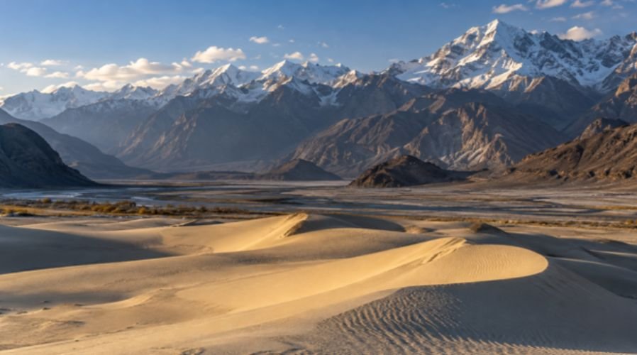
Skardu sits at the confluence of the Indus and Shigar Rivers. It serves as the primary staging ground for mountaineers tackling K2, Broad Peak, and Gasherbrum. The landscape feels distinctly Tibetan, dominated by broad valleys, cold deserts, and high alpine plateaus.
The Katpana and Sarfaranga cold deserts present an incredible sight: high sand dunes dusted with snow during winter, flanked by jagged Himalayan peaks.
A short drive away lies the vast Deosai National Park. Averaging over 13,400 feet, Deosai is the second-highest alpine plateau on Earth, inhabited by the endangered Himalayan brown bear and carpeted in wildflowers each July.
Before heading out into these remote zones, international travelers should verify regional permits and check current consular updates via the U.S. Department of State Travel Advisory to ensure safe passage through transit checkpoints.
- Key Highlights: Katpana Cold Desert, Deosai Plains, Shangrila (Lower Kachura) Lake, historical Shigar Fort.
- Best Window: June to September, when mountain tracks and high plateau routes melt clear of snow.
The Lush Sanctuaries of Khyber Pakhtunkhwa
If Gilgit-Baltistan delivers sheer rock and vertical drama, Khyber Pakhtunkhwa provides dense deodar cedar forests, charging whitewater rivers, and alpine meadows.
Kaghan Valley: River Runs and High-Altitude Passes
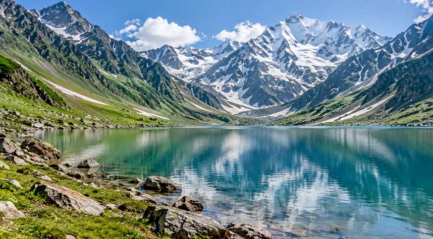
Kaghan is the most accessible mountain escape from Islamabad. Following the Kunhar River along the N-15 highway, the valley climbs steadily from subtropical hills into cool alpine forests.
Naran acts as the bustling hub of the valley. From here, rugged jeeps climb the rough track to Lake Saif-ul-Malook, a glacial lake set at 10,577 feet beneath Malika Parbat. Continuing north past Batakundi, the road climbs up to Babusar Top at 13,690 feet.
This pass offers clear views across the Chilas mountain junction and connects travelers directly to the Karakoram Highway during summer months.
- Key Highlights: Lake Saif-ul-Malook, Shogran and Siri Paye alpine meadows, Babusar Pass.
- Best Window: Late June to early October. Heavy winter snow completely buries the upper pass from November to May.
Kumrat Valley: Untamed Pine Wilderness
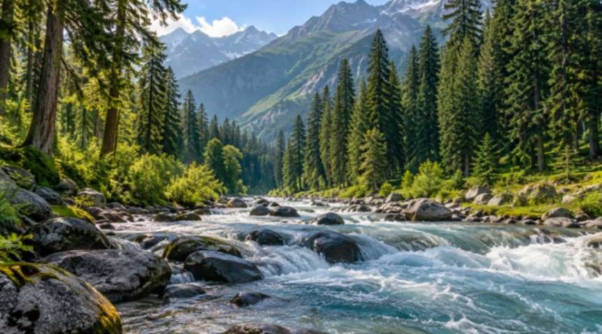
Kumrat remains one of northern Pakistan’s most pristine destinations. Located in Upper Dir along the roaring Panjkora River, it lacks the heavy commercial hotel rows of Kaghan.
Tall deodar forests line the valley floor, creating dark green canopies that block out the sun. The sound of river rapids is constant. Kumrat rewards self-sufficient campers who bring their own gear, hire local guides, and hike up to the high glacial basins of Katora Lake and Jahaz Banda.
- Key Highlights: Deodar forest trail, Panjkora Riverbanks, Do Kala waterfall, trek to Katora Lake.
- Best Window: June to September for dry trails and open mountain passes.
Road Accessibility, Drive Times, and Vehicle Strategy
Reaching these valleys requires matching your vehicle to the specific route. Selecting the wrong vehicle can stall your journey at mountain trailheads.
ISLAMABAD (Base Hub)
├── Hazara Motorway (M-15) ──► Kaghan Valley (6–8 hrs) ──► Babusar Top ──► KKH Junction (Summer only)
├── Motorway M-1 / M-16 ─────► Timergara ──────────────► Thal / Kumrat (10–12 hrs)
└── Karakoram Hwy (N-35) ────► Chilas ─────────────────► Jaglot
├── S-1 Strategic Hwy ──► Skardu (18–24 hrs)
└── N-35 Main Highway ──► Hunza (14–16 hrs)
The newly upgraded Jaglot-Skardu Strategic Highway (S-1) has replaced the old unpaved track through the Indus gorge with a modern, two-lane asphalt road. Standard family sedans can now reach Skardu city without damage. However, ascending to Deosai National Park or Basho Valley still requires a dedicated four-wheel-drive vehicle with high ground clearance.
Hunza features reliable pavement all the way through Sost up to the Khunjerab Pass on the Chinese border. Kaghan’s N-15 is similarly paved up to Babusar Top, though spring rockfalls require alert driving. Kumrat presents the toughest road conditions: smooth motorways lead to Chakdara, but the dirt track past Thal turns rocky, muddy, and rutted. A 4×4 is essential once you enter the valley interior.
Altitude Acclimatization and Logistics Blueprint
Jumping rapidly from Islamabad’s low elevation (1,770 feet) to the high plateaus of Gilgit-Baltistan risks Acute Mountain Sickness (AMS). Before finalizing an overland route across multiple Asian destinations, travelers should also check visa requirements for travel across Asia to confirm that entry rules and permits align with their planned itinerary.
When heading to Skardu or Hunza, avoid driving straight through in a single 20-hour push. Spend a night in Shogran, Naran, or Chilas. If you are building a multi-destination journey across Asia, this guide on how to create a two-week Asia travel itinerary can help you structure travel days, balance time between destinations, and avoid an overly rushed route.
- Keep your tank full. Fuel stations thin out past Abbottabad and Gilgit.
- Carry cash. ATMs in Karimabad, Thal, and Naran frequently experience network dropouts.
- Purchase a local Special Communications Organization (SCOM) SIM card in Gilgit or Skardu, as national telecoms lose signal in deep gorges.
For official updates on park fees, open trails, and road work, consult the Government of Gilgit-Baltistan Tourism Department.
Pack Your Bags, Check Your Brakes
The mountains of northern Pakistan deliver an authentic wilderness experience that few places can match. Whether you want the comfortable hotels and fortress history of Hunza or the wild, untamed rivers of Kumrat, proper timing makes all the difference.
Map your route, verify your pass openings before leaving Islamabad, and give these massive peaks the respect they deserve.
Frequently Asked Questions
1. Which is the most beautiful valley in northern Pakistan?
Hunza Valley is widely considered the most scenic due to its terraced orchards, towering 7,000-meter peaks, and historic stone forts.
2. Can you drive a standard sedan to Skardu and Hunza?
Yes, standard sedans can easily navigate the paved Karakoram Highway to Hunza and the newly upgraded Jaglot-Skardu Road (S-1) to Skardu city.
3. When is the best time to visit valleys in northern Pakistan?
July through September offers open roads and warm weather, while October brings dry days and colorful autumn foliage.
4. Do American travelers need a special permit for Gilgit-Baltistan?
Standard tourist visas cover Gilgit, Hunza, and Skardu, but a licensed mountain guide and trekking permits are required for designated border or military zones.